As we planned our trip to Beebe Hill State Forest and surrounding area for the Empire State Mountain Unicycle Festival, I looked around at what I might do with the kids. I found one trip report from 2010 of a hike up to the Beebe Hill Fire Tower. That sounded perfect for us. However I am always directionally challenged and wished for a map. The above link also has a lot of history about the area and the Fire Tower.
When we arrived for day 1 of the Muni Festival, a park ranger was in the parking lot. I asked him about the hike and where we should start. Of course I asked about a map too, but he didn't have any. After a few minutes in his truck, he brought me a hand drawn map, complete with color coding! Thanks, Chris! It was a big help!
We crossed Fog Hill Rd to reach the closer parking lot for the Fire Tower Hike. There was a small kiosk and two trails. The Fire Tower trail is to the left, further from the kiosk.
 |
| Bartlett Pond |
 |
| Fire Tower Trail starts here |
 |
| Blue Trail |
First we followed the blue trail. There were a couple bridges and streams.
Along the trail there was a place to register and a sign telling us it was .1 miles back to the parking lot.
Soon we needed to make a decision and knew we had to go on the red trail to reach the Fire Tower.
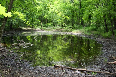
Towards the top we found Opal Pond. It was pretty swampy.
We didn't notice a lean to or see the Fire Tower until we hit the clearing. Perhaps when the leaves aren't on the trees it's possible to see the tower before reaching it.
 |
| Locked up Cabin |
The tower is 60 feet. There is small fencing on the walls of the tower.
 |
| Beebe Hill State Forest Fire Tower |
 |
| Under the Tower |
 |
| The view |
 |
| In the tower out of the wind for a snack |
At the top of the tower it was very windy! The tower itself seemed very secure and didn't feel like it was swaying or moving at all. Unfortunately the little one did feel scared so high up and needed reassurance staying up there and getting down.
 |
| Looking down! |


No comments:
Post a Comment